
High-quality Japan data available for all developers
- The Tech Platform

- Jun 27, 2020
- 2 min read
We’ve just launched the highest quality maps in Japan. Mapbox maps now support highly detailed Japanese data, Japanese glyphs, global Japanese labels, bilingual labels, and vertical label orientation.

Integrating Zenrin Data
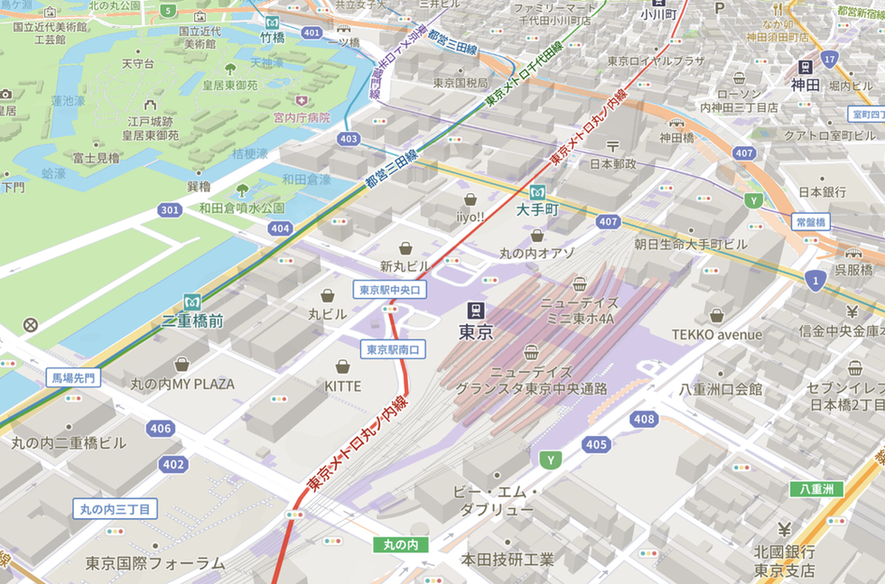
We partnered with Zenrin, the leading provider of Japanese location data, to bring enhanced map data to our services in Japan, and that data is now live for all developers. Zenrin has more than 70 years of experience mapping Japan, with data covering nearly 99% of all Japanese roads and neighborhoods. This data improves our coverage of smaller Japanese towns, urban streets and buildings, alleys, pathways, and addresses — in Japanese and English. By integrating Zenrin data into our living map platform, we’re now able to provide real-time traffic and dynamic change detection in Japan.
The data we’re releasing with this update is the same one powering all maps for Yahoo! JAPAN. Feedback from their millions of users, as well as anyone else who uses our maps, allows us to continually improve our maps by identifying missing streets, isolating precise traffic problems, and more.
Our living map is made from 130+ data sources, now including Zenrin, Microsoft, and validated crowdsourced data — allowing us to build the most accurate map for developers. Developers can access this data in the latest version of our map data. We’ve also created a map style that meets the unique requirements and expectations of the Japanese market. Take a look at some key improvements available in this update:
Comprehensive Japanese address system: Japanese addresses incorporate both house numbers in addition to block numbers. These numbers are important labels for wayfinding, navigation, and logistics use cases.
Expanded building coverage: We now have near-complete building coverage in Japan. The updated building data also includes height coverage for nearly all buildings in Japan, meaning developers can extrude buildings in 3D.
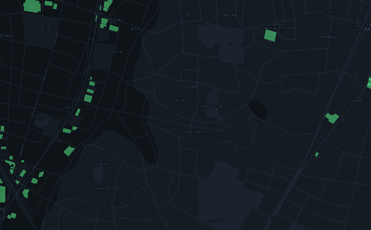
Increased building coverage in Ōsaka
Localized icons and highway shields: Standard Japanese symbols called chizukigou are important for representing real-world places accurately on a map. We’ve added a new set of localized icons specifically for a Japanese audience to our Maki icon set.


Japanese icons for bank, castle, cemetery, school, hospital, fire station, police station, post office, and landmark (top left to bottom right).
Intersection labels: Minor roads in Japan often do not have names, so drivers typically use intersection labels to effectively navigate a city.
Detailed transit lines: Transit lines are critical landmarks for navigation in Japan. This update adds Japanese transit lines to our maps, which provides the necessary context for consumer navigation use cases.


Getting Started
Starting building with Style Components in Mapbox Studio to start using this data. In the coming months, keep an eye out for a number of continued improvements to our map including pedestrian-level road detail, indoor data covering Japanese metro stations, Japan-specific traffic data from JARTIC, and immersive navigation experiences.
Have questions about our map in Japan? Get in touch with our team in Japan to meet our local in-country experts.
Source: Paper.li


Comments